Hiking the Oak Woodlands
November 3, 2022
Golden Gate Park isn’t what you think of as a hiking park. It’s not particularly naturalistic. The whole area used to be windswept sand dunes, and was transformed by water piped in from Hetch Hetchy 70 miles away to resemble parks in New England, a completely different climate.
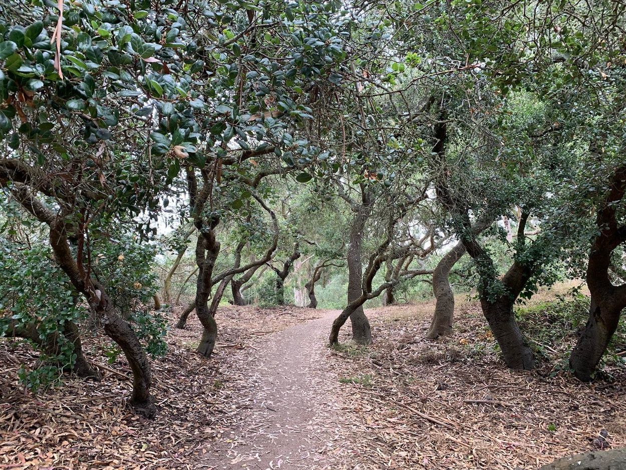
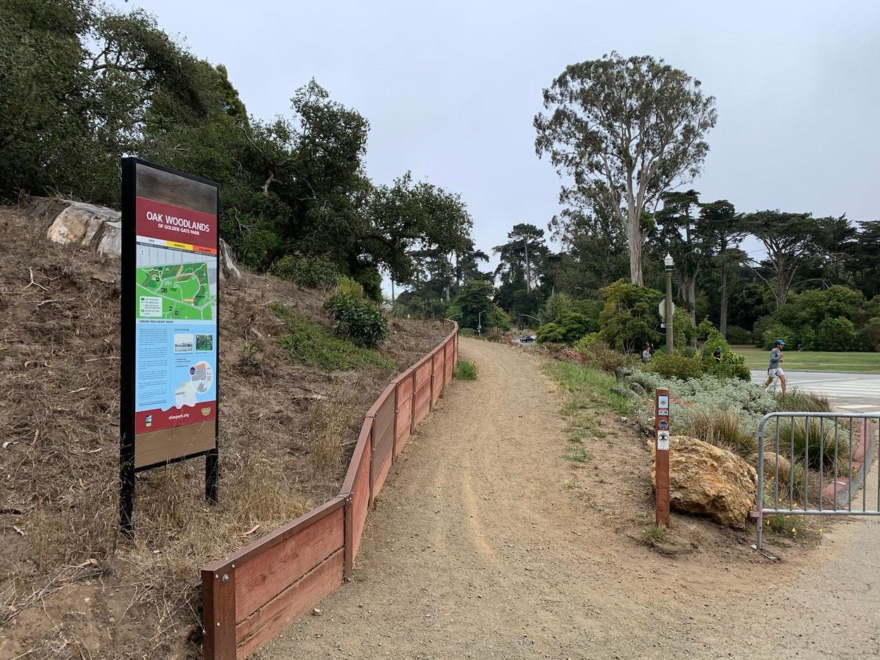
There’s an exception, though: the Oak Woodlands. It’s the one patch of native forest in western San Francisco, where coast live oak trees have stood since before the arrival of the Spanish. And it makes for a great transit-oriented hike, no car needed.
This is an easy 1.9 mile hike through the Oak Woodlands and the adjacent, not naturally occurring but also pretty, Heroes Grove. You can optionally extend it to a 3.3 mile hike with a strenuous climb up to Blue Heron Lake and Strawberry Hill. It starts at the intersection of Haight and Stanyan.
By transit: Take the Muni 7 bus from points east (from East Bay, Civic Center BART is the best transfer point) to Haight & Stanyan. Or from the Mission, take the Muni 33 bus to Haight & Stanyan. Or use any transit trip planner to explore other options: the start point is also within a few blocks of the N-Judah, 21, 5, and 43.
By bike: You can ride in from the east on Fell Street (has a protected bike lane, but some dodgy intersections) or Page Slow Street (usually calm, but one block is hilly). I’d recommend you lock up at the bike racks at McLaren Lodge, two blocks north of Haight & Stanyan, start by walking west from there instead, and take the free Golden Gate Park shuttle back to your bike at the end.
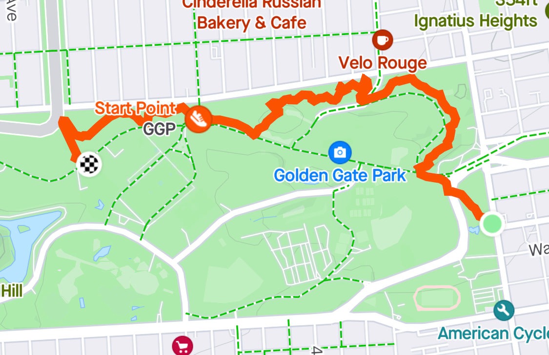
From Haight & Stanyan, enter Golden Gate Park and walk on the park trails northwest, passing the bocce courts, and cross Kezar at the signal. On the far side of Kezar, turn right, then left on JFK Promenade. Turn right on Conservatory Drive East and immediately right again to enter the Phil Arnold Trail.
Enjoy the forest ambiance as the trail takes you winding around through the oaks. In one place, there’s a fork where you can optionally take some stairs to the right to a higher area with a bit of a lookout, before merging back with the main path. That way is nice too, but for my recommended hike, continue straight, past the horseshoe pits.
When the trail completes its curve west, through gaps in the trees you can occasionally see houses lining Fulton Street, and even the Bay and the Golden Gate Bridge in the background. You’ll cross a lightly trafficked road: Arguello, just below the intersection with Conservatory Drive. The trail continues on the opposite side with steps down.
Finally, the Oak Woodlands Trail ends at a T intersection with a paved trail. Turn left. At JFK Promenade, turn right and walk the path along the promenade, passing the Skatin’ Place on your right, among other attractions. This is the least naturalistic part of the hike, but at least there are no cars.
You’ll be back in the woods before long. Just after you pass over the ramp to the museum parking garage (at right), make a slight right.
Pass the Blue Playground, and you’re in the Heroes Grove. A plaque here memorializes San Franciscans who died in the first World War. Stop to reflect if you like, and proceed under the beautiful redwoods.
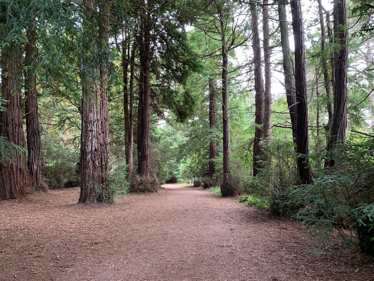
Continue on this trail until you exit the redwood forest up some steps, at the Rose Garden. Turn left and return to JFK Promenade.
This is the end of the hike, and you now have a few options:
- Ride the free Golden Gate Park shuttle back to the start point
- Walk north out of the park to the Muni 5 or south out of the park to the 7, back toward the start point and points east
- Walk back on JFK Promenade, making it a loop
- Add a strenuous but scenic extension by climbing Strawberry Hill
Strawberry Hill: optional extension
Cross JFK, turn right and then left on the uphill path, entering a wooded area. Just before you would come out at the Japanese Tea Garden, turn right, up the staircase. You’ll emerge on Blue Heron Lake Drive. Walk left around the lake until you get to the stone bridge.
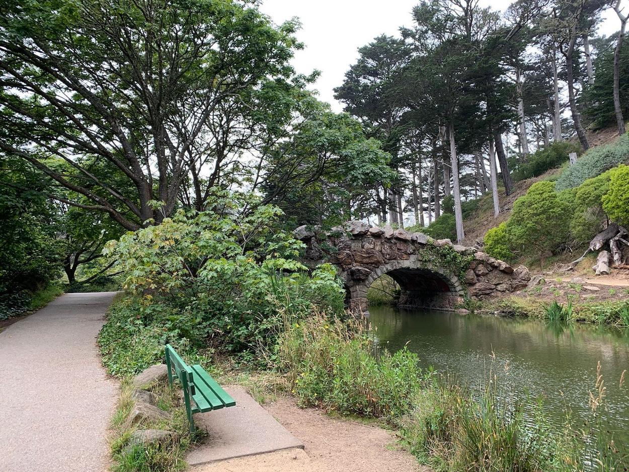
Cross the bridge, turn right, and then slight left to climb to the top of Strawberry Hill via the steep trail and steps. There’s a picnic area up top, as well as great views. It’s worth doing a loop around the hilltop. Then take the steps down to the east, turn left, and turn right across the other bridge, and left to return to the Blue Heron Lake Boathouse. You can catch the shuttle here as well, or proceed north to JFK Promenade.
I hope this showed you a new way to enjoy Golden Gate Park. Thanks to Yes on J voters in November 2022, the JFK Promenade will stay car-free forever, without which this hike would have much more traffic noise and be way less calming.
I’m big on hikes you can do without a car, because cars are the single biggest contributor to carbon emissions in California. Getting there by transit helps preserve the great outdoor places we love. I previously wrote about a much longer Bay Area transit hike in the Fremont area, at Vargas Plateau.
Note: This blog post was updated in 2024 to reflect the current name of Blue Heron Lake and change references to November 2022 Prop J to the past tense.
You can follow me on Mastodon or Bluesky, or this blog via RSS.
